


BEEBE Voting District, Fremont County, Wyoming
About
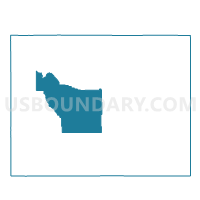
Outline

Summary
| Unique Area Identifier | 698590 |
| Name | BEEBE Voting District |
| County | Fremont County |
| State | Wyoming |
| Area (square miles) | 514.43 |
| Land Area (square miles) | 510.52 |
| Water Area (square miles) | 3.92 |
| % of Land Area | 99.24 |
| % of Water Area | 0.76 |
| Latitude of the Internal Point | 42.75932130 |
| Longtitude of the Internal Point | -108.72804390 |
Maps


Graphs
Select a template below for downloading or customizing gragh for BEEBE Voting District, Fremont County, Wyoming


Neighbors
Neighoring Voting District (by Name) Neighboring Voting District on the Map
- ATLANTIC CITY Voting District, Fremont County, WY
- BOULDER Voting District, Sublette County, WY
- ETHETE Voting District, Fremont County, WY
- FORT WASHAKIE Voting District, Fremont County, WY
- HUDSON Voting District, Fremont County, WY
- JEFFREY CITY Voting District, Fremont County, WY
- LANDER #5 Voting District, Fremont County, WY
- LANDER #6 Voting District, Fremont County, WY
- LUTHY Voting District, Fremont County, WY
- MILFORD Voting District, Fremont County, WY
- RECLAMATION Voting District, Fremont County, WY
Top 10 Neighboring County Subdivision (by Population) Neighboring County Subdivision on the Map
- Wind River CCD, Fremont County, WY (26,330)
- Lander CCD, Fremont County, WY (11,019)
- Boulder CCD, Sublette County, WY (401)
- Jeffrey City CCD, Fremont County, WY (144)
Top 10 Neighboring Place (by Population) Neighboring Place on the Map
Top 10 Neighboring Unified School District (by Population) Neighboring Unified School District on the Map
- Fremont County School District 25, WY (16,987)
- Fremont County School District 1, WY (11,330)
- Sublette County School District 1, WY (6,932)
- Fremont County School District 14, WY (2,344)
- Fremont County School District 21, WY (2,190)
Top 10 Neighboring State Legislative District Lower Chamber (by Population) Neighboring State Legislative District Lower Chamber on the Map
- State House District 22, WY (12,218)
- State House District 33, WY (9,942)
- State House District 54, WY (9,560)
- State House District 34, WY (9,254)
- State House District 48, WY (8,185)
Top 10 Neighboring State Legislative District Upper Chamber (by Population) Neighboring State Legislative District Upper Chamber on the Map
- State Senate District 16, WY (23,184)
- State Senate District 25, WY (19,502)
- State Senate District 26, WY (18,754)
- State Senate District 12, WY (17,585)
Top 10 Neighboring 111th Congressional District (by Population) Neighboring 111th Congressional District on the Map
Top 10 Neighboring Census Tract (by Population) Neighboring Census Tract on the Map
- Census Tract 1.02, Sublette County, WY (5,926)
- Census Tract 9402.02, Fremont County, WY (4,832)
- Census Tract 3, Fremont County, WY (4,422)
- Census Tract 9401, Fremont County, WY (3,951)